Global Trends Today
  • News
  • Economy
  • Investing
  • Stock
  • Editor’s Pick
No Result
View All Result
  • News
  • Economy
  • Investing
  • Stock
  • Editor’s Pick
No Result
View All Result
Global Trends Today
No Result
View All Result
Home Investing

Satellite Imagery and Gold Exploration (Updated 2024)

by
September 12, 2024
in Investing
0
Satellite Imagery and Gold Exploration (Updated 2024)
0
SHARES
1
VIEWS
Share on FacebookShare on Twitter

Exploring for gold is a costly endeavor that often comes with great risks, especially for junior mining companies.

These small-scale companies are faced with the challenge of locating a metal that is extremely rare, and even if they do find it, they need to ensure gold is present in economically viable quantities.

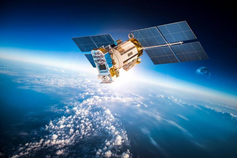
That’s where the use of satellite imagery and remote sensing comes in. Using satellite systems helps explorers survey land without having to invest heavily in equipment or develop on-site infrastructure.

What was the original Landsat system?

When the first Landsat satellite was launched in 1972, geologists used sensors to collect simple data, such as surface features. They were able to get clues on potential mineral deposits beneath the surface, and could use the data for mapping. However, since then, imaging sensor technology has undergone rapid advancements that have allowed explorers to collect increasingly more useful data.

The very first sensors used on satellites were problematic, mainly because of their poor spectral resolution and inadequate spectral coverage. These limitations rapidly changed in the early 1980s with the launch of Landsat 4 and 5, which carried the Thematic Mapper scanning system. The system added coverage of the short-wave infrared and mid-infrared regions of the spectrum.

The Thematic Mapper scanning system is still used as an exploration tool, but newer satellites have been launched with better spectral resolution and accuracy when determining surface mineralogy.

Satellites are now fitted with hyperspectral sensors that identify materials without having to view them in person. Spectral data is collected by aircraft and satellites using infrared, near-infrared, thermal-infrared and short-wave technology. Geologists can use this data to pick out rock units and find clues about subsurface deposits of minerals, oil and gas and groundwater.

The technology in satellite systems has advanced to the point where they can be used to identify and map not only individual mineral species, but also chemical variations within the molecular structure of the crystal lattice of the mineral.

The resolution of sensors on satellites can’t be compared to aircraft spectral remote sensors, but these satellites do come with other advantages. For example, satellite systems are able to collect more data from larger areas without having to fly any aircraft over the land of interest.

What are the benefits of satellite imagery in mineral exploration?

With the ability to determine texture and type from miles above the ground, locating, analyzing, identifying and mapping the composition of the Earth’s surface is now greatly advanced. Here are a few benefits of using satellite imagery in mineral exploration.

Lower costs and risks

Satellite imagery helps reduce the cost of surveying land due to the fact that on-site personnel and equipment aren’t needed. Explorers can instead use a number of data sources to draw valuable insights for potential projects. This is especially helpful for juniors that have to justify risks to gather financing or begin operations.

Value across the lifecycle

Geospatial data is critical to mineral exploration, but it can also be applied to all phases of the mining lifecycle. Satellite images can be used to inform activities like building mine infrastructure or anticipating risks that are linked to a site’s geography. The relatively low cost and high utility of satellite imagery makes it a versatile technology for explorers.

Data abundance

The advancement of sensor technologies has allowed companies to combine valuable satellite data with other information sources like drone mapping, feasibility studies and historical data about geographical sites.

Satellite imagery also helps gather data that otherwise wouldn’t be attainable due to challenges in topography or climate. Diversifying information sources and increasing the sheer amount of available data means miners and scientists can gather new insights through their analysis.

Satellite imagery certainly isn’t the only tool available to explorers, but it serves as an excellent complement to more accurate and resource-intensive technologies like LiDAR, GPS surveying and unmanned aerial vehicles.

Securities Disclosure: I, Melissa Pistilli, hold no direct investment interest in any company mentioned in this article.

This post appeared first on investingnews.com
Previous Post

How Will the US Election Affect the Crypto Industry?

Next Post

Harris puts pressure on Trump in an elusive battleground: North Carolina

Next Post
Harris puts pressure on Trump in an elusive battleground: North Carolina

Harris puts pressure on Trump in an elusive battleground: North Carolina

    Fill Out & Get More Relevant News


    Stay ahead of the market and unlock exclusive trading insights & timely news. We value your privacy - your information is secure, and you can unsubscribe anytime. Gain an edge with hand-picked trading opportunities, stay informed with market-moving updates, and learn from expert tips & strategies.

    • Trending
    • Comments
    • Latest

    Hacker lexicon: What is a supply chain attack?

    June 11, 2021

    Losing Depop to US ownership makes the British tech sector look secondhand

    June 11, 2021

    Andrew Lloyd Webber to sue the Government if theatres are not fully reopened from June 21

    June 11, 2021

    Microsoft’s Kate Crawford: ‘AI is neither artificial nor intelligent’

    June 11, 2021
    Radiopharm Theranostics Accelerates 177Lu-RAD204 Phase 1 Dose Escalation Clinical Trial Based on Positive Recommendation from Data Safety and Monitoring Committee

    Radiopharm Theranostics Accelerates 177Lu-RAD204 Phase 1 Dose Escalation Clinical Trial Based on Positive Recommendation from Data Safety and Monitoring Committee

    0

    Reply to “Reply to Whitehead” by Desvousges, Mathews and Train: (4) My treatment of the weighted WTP is biased in favor of the DMT (2015) result/conclusion

    0

    The 40 Weirdest (And Best) Charts We Made In This Long, Strange Year

    0

    Will The Debate Over $2,000 Stimulus Checks Help Democrats In Georgia?

    0
    Radiopharm Theranostics Accelerates 177Lu-RAD204 Phase 1 Dose Escalation Clinical Trial Based on Positive Recommendation from Data Safety and Monitoring Committee

    Radiopharm Theranostics Accelerates 177Lu-RAD204 Phase 1 Dose Escalation Clinical Trial Based on Positive Recommendation from Data Safety and Monitoring Committee

    May 12, 2025
    Triumph Gold Discovers a New Silver and Gold Vein Showing at the Freegold Mountain Project, Yukon

    Triumph Gold Discovers a New Silver and Gold Vein Showing at the Freegold Mountain Project, Yukon

    May 12, 2025
    Falco Files Requested Documentation for the Horne 5 Project’s Environmental Authorization Process

    Falco Files Requested Documentation for the Horne 5 Project’s Environmental Authorization Process

    May 12, 2025
    Nuvau Minerals Completes High Resolution Drone MAG Survey

    Nuvau Minerals Completes High Resolution Drone MAG Survey

    May 12, 2025

    Recent News

    Radiopharm Theranostics Accelerates 177Lu-RAD204 Phase 1 Dose Escalation Clinical Trial Based on Positive Recommendation from Data Safety and Monitoring Committee

    Radiopharm Theranostics Accelerates 177Lu-RAD204 Phase 1 Dose Escalation Clinical Trial Based on Positive Recommendation from Data Safety and Monitoring Committee

    May 12, 2025
    Triumph Gold Discovers a New Silver and Gold Vein Showing at the Freegold Mountain Project, Yukon

    Triumph Gold Discovers a New Silver and Gold Vein Showing at the Freegold Mountain Project, Yukon

    May 12, 2025
    Falco Files Requested Documentation for the Horne 5 Project’s Environmental Authorization Process

    Falco Files Requested Documentation for the Horne 5 Project’s Environmental Authorization Process

    May 12, 2025
    Nuvau Minerals Completes High Resolution Drone MAG Survey

    Nuvau Minerals Completes High Resolution Drone MAG Survey

    May 12, 2025

    Disclaimer: GlobalTrendsToday.com, its managers, its employees, and assigns (collectively "The Company") do not make any guarantee or warranty about what is advertised above. Information provided by this website is for research purposes only and should not be considered as personalized financial advice. The Company is not affiliated with, nor does it receive compensation from, any specific security. The Company is not registered or licensed by any governing body in any jurisdiction to give investing advice or provide investment recommendation. Any investments recommended here should be taken into consideration only after consulting with your investment advisor and after reviewing the prospectus or financial statements of the company.

    • Privacy Policy
    • Terms & Conditions

    Copyright © 2025 globaltrendstoday.com | All Rights Reserved

    No Result
    View All Result
    • News
    • Economy
    • Investing
    • Stock
    • Editor’s Pick

    Copyright © 2025 globaltrendstoday.com | All Rights Reserved